Adelaide Metro Journey Planner
Designed and implemented in 2004.
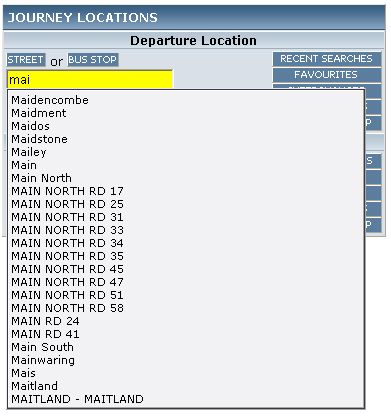
Real-time suggestions as you type.
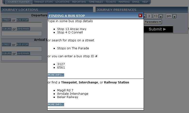
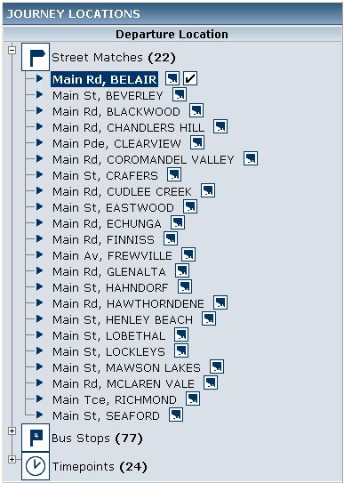
Searching for a street or bus stop:
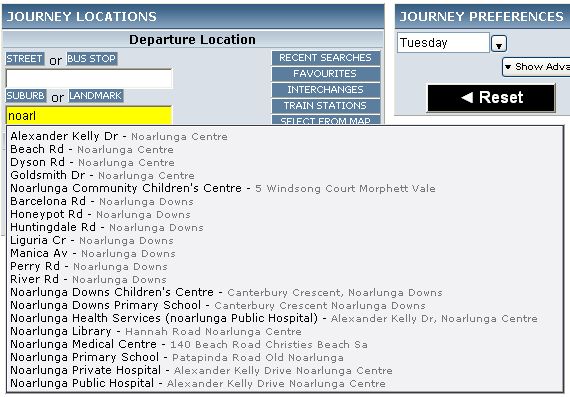
Searching for a Suburb or
Landmark/Location/Business/etc.
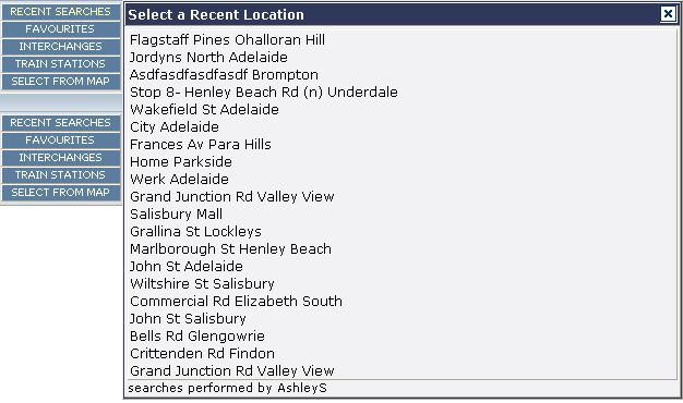
Using quick-select tools.
Selecting from recently searched list of
locations:
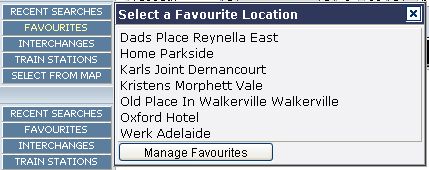
Selecting from (user-manageable) Favourites list:
Selecting from list of transit Interchanges:

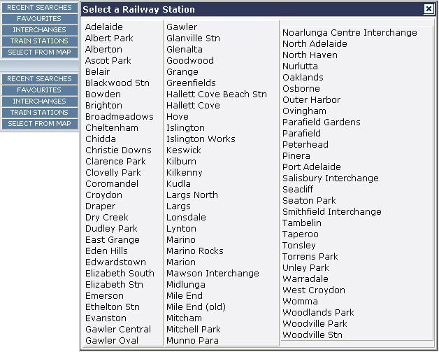
Selecting from list of train stations:
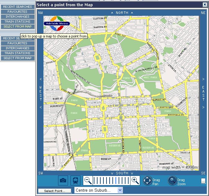
Selecting by pointing and clicking at the map:
Variety of help prompts for all features just a click away to assist with
possible options:
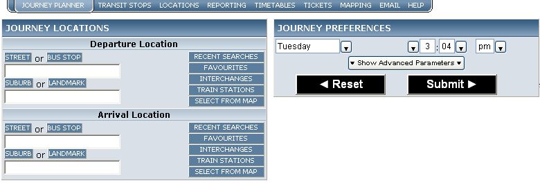
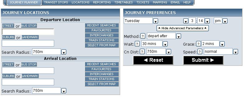
Advanced parameters available for those who would like more control over the
search criteria:
Intermediate confirmation stage of selecting a location:
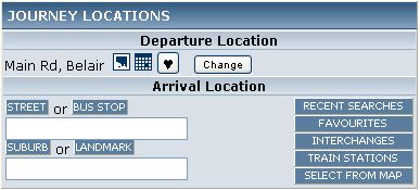
Location has been selected and confirmed:
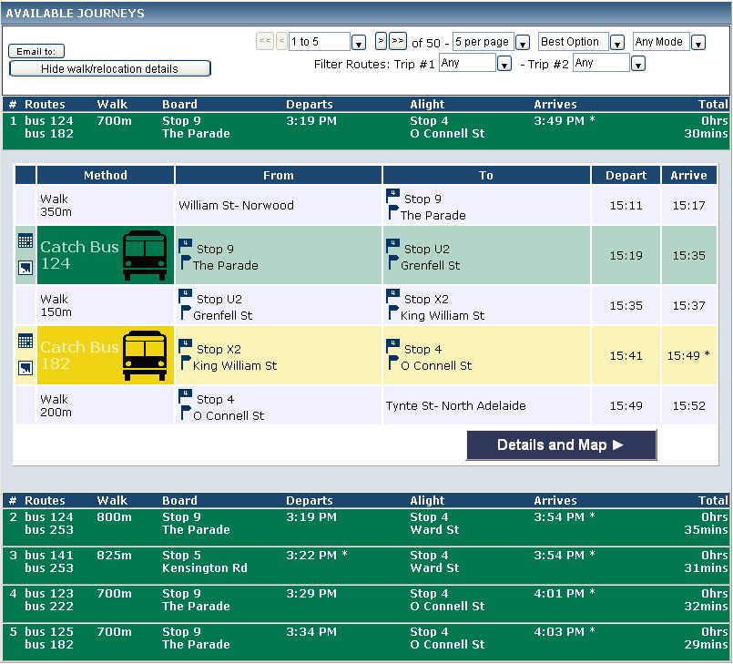
Results overview of journey plan:
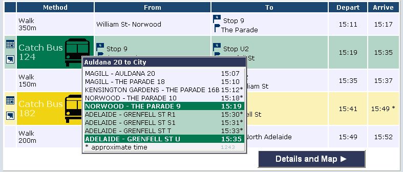
Individual trip timetable appears on hover over bus symbol:
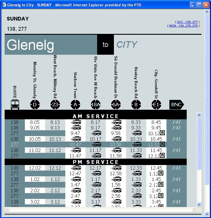
Full timetable available by clicking on timetable icon:
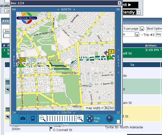
Route map for relevant trip available when clicking on the map symbol:
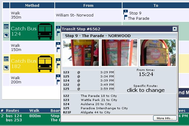
Bus stop details available by clicking on bus stop icon:
Neat static version available for printout or export to PDF:
click
here to see a PDF version of this printout (as emailed to customers)

Further detailed results available about any specific journey option:
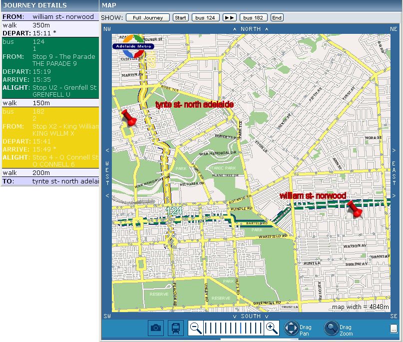
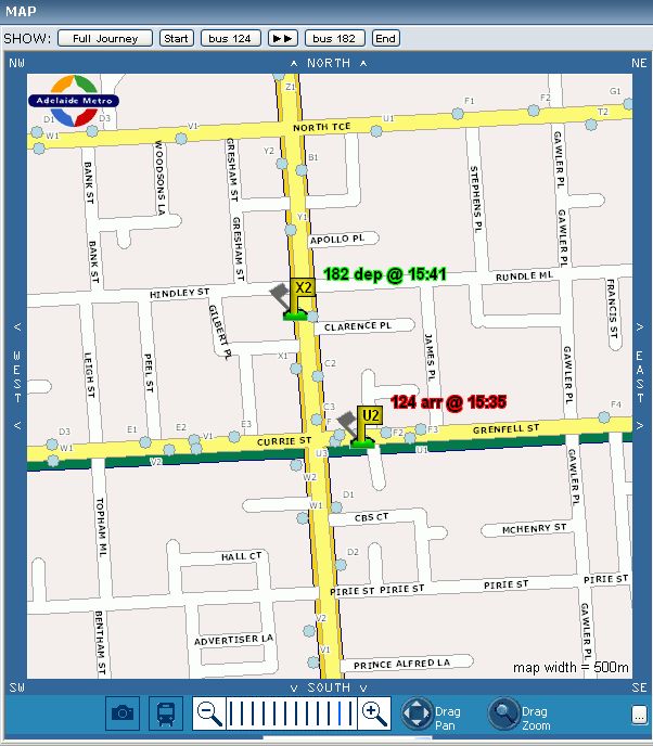
All maps of individual legs of the journey are available by clicking on the
relevant SHOW button at the top of the map:
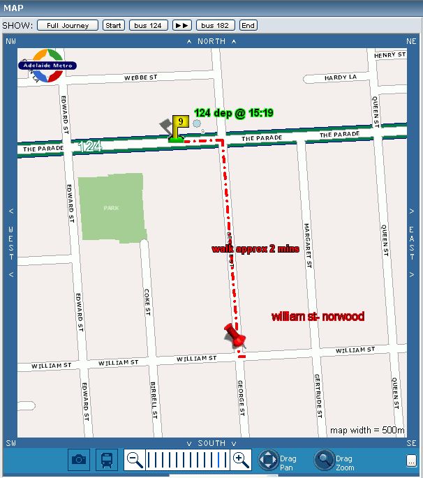
Map of start of journey, how to get from start location to the departure
point of the first trip:
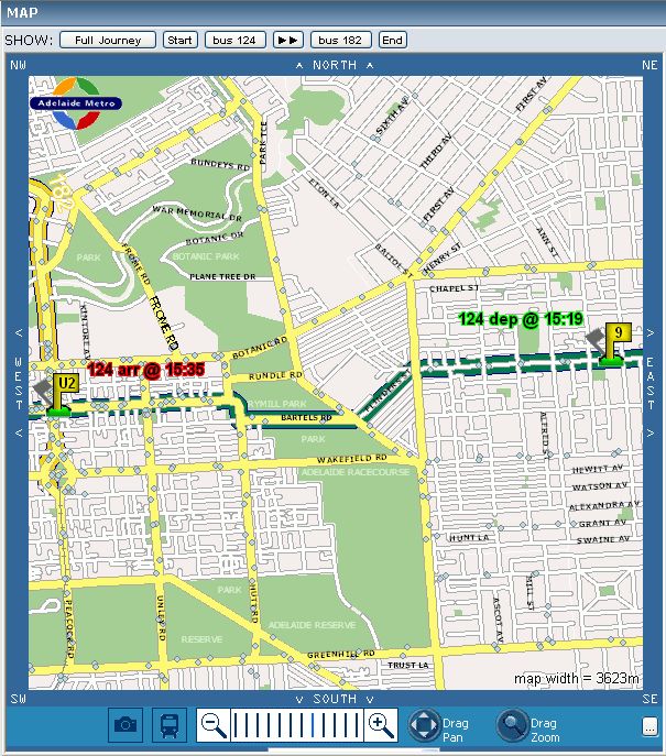
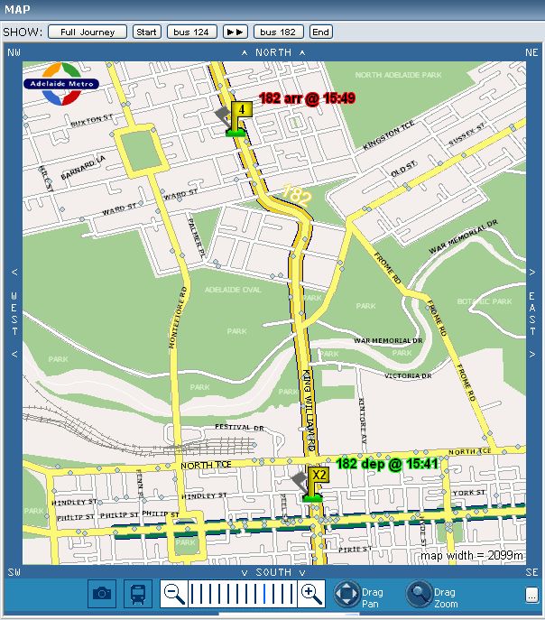
Map of first bus trip of journey:
Map of transfer details between trip 1 and 2 of journey:
Map of trip second trip of journey:
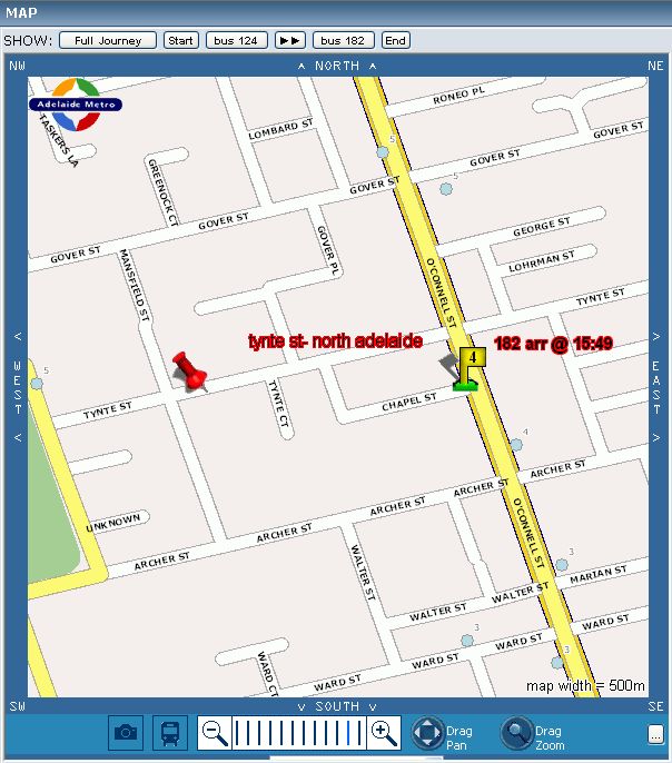
Map of final leg of journey, how to get from the alight point of the final
trip to the destination:
Detailed map results can also be printed out or exported to PDF.
click
here for an example of outputs sent to customers
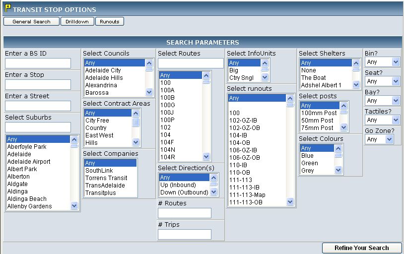
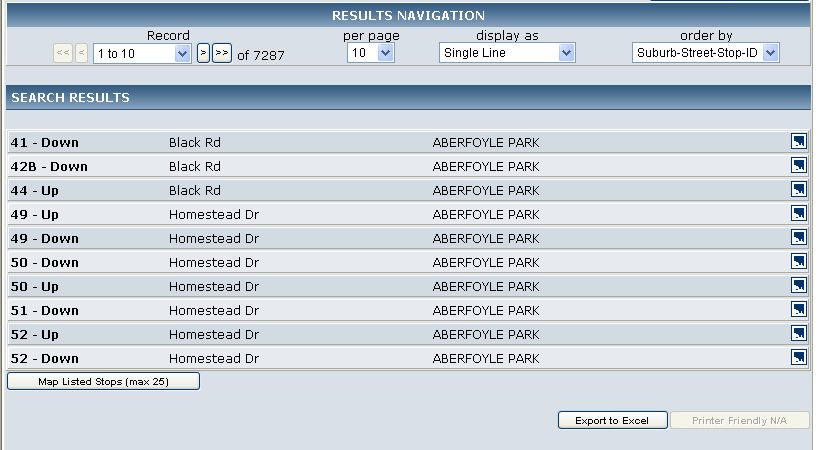
Bus Stops
Bus stops can be searched via the following criteria:
The results and navigation tools of a search:
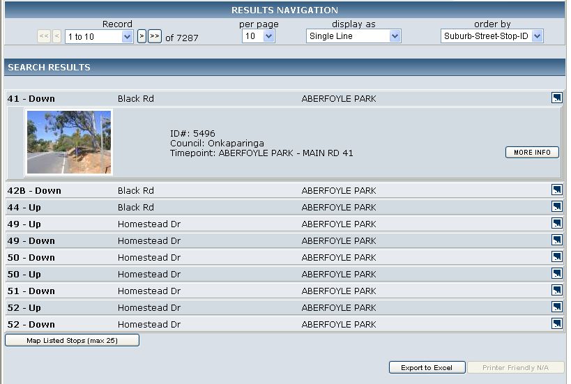
Any bus stop result may be expanded upon, this is done through asynchronous
calls to the server and so appears immediately without a page refresh:
Results can have a custom output, with a large range of possible fields:
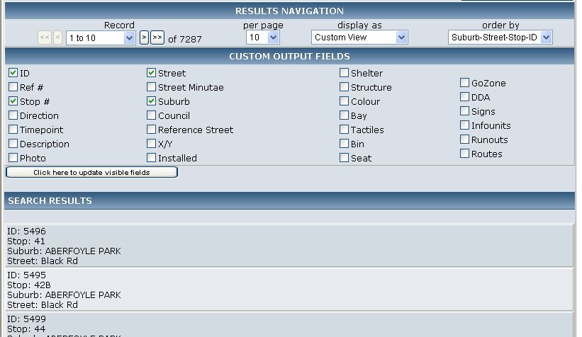
Data can be directly exported to Microsoft Excel, click
here for a sample output.
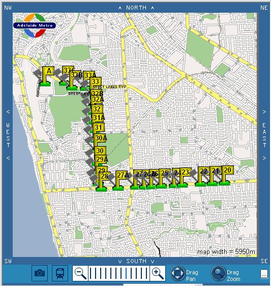
Listed stops can be mapped at the click of a button:
Each bus stop has it’s own host of details associated with it:
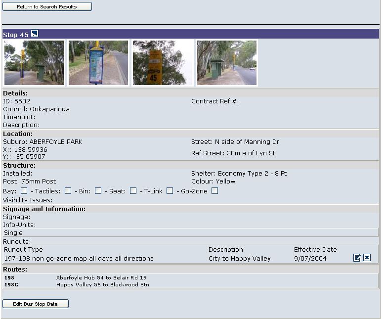
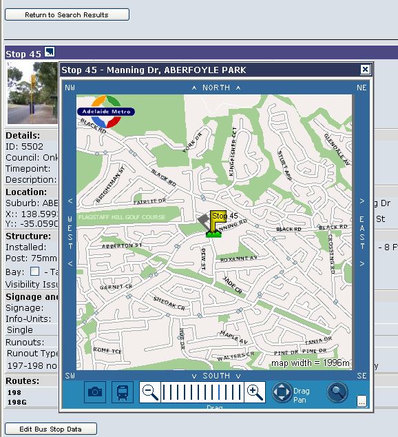
Show the location of the bus stop by clicking on the map icon:
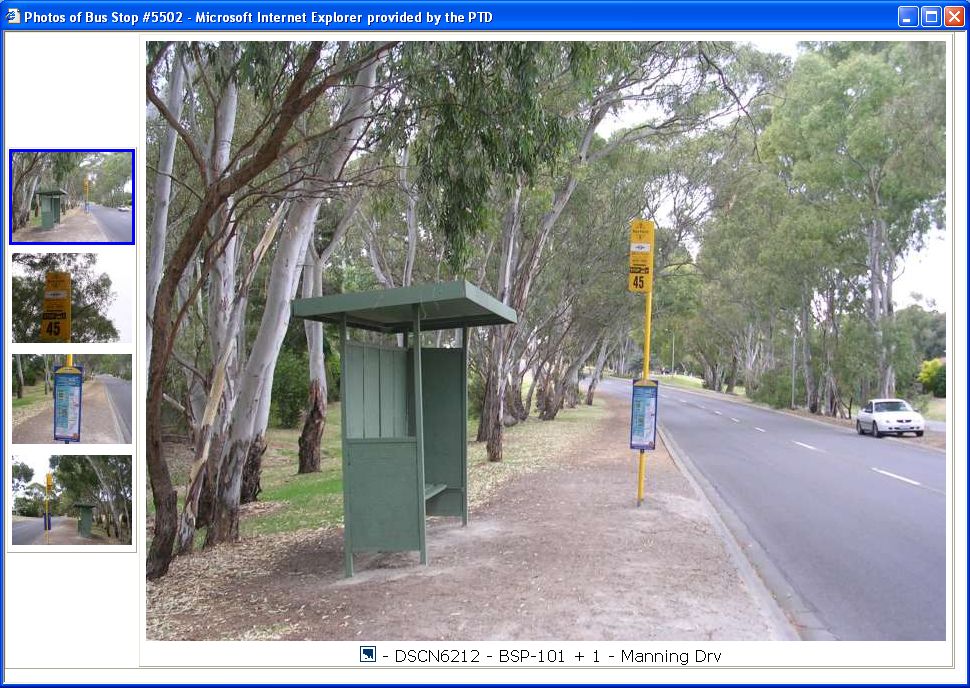
Browse the photographs of the bus stop by clicking one of the thumbnails:
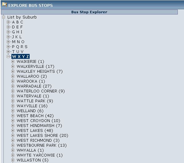
Search for bus stops by using the drilldown method:
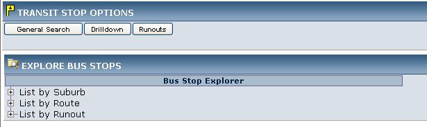
Drilldown explorer tree is expandable to reveal further options for nailing
down the data you’re after, numbers in brackets tell how many stops within each
section:
Drilldown further, see all stops or stops per street:
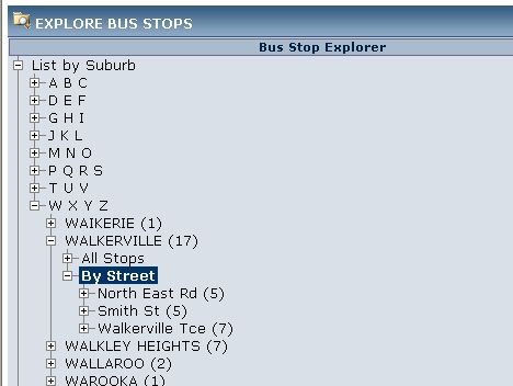
And the details available, with a link to further information if required:

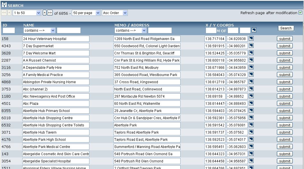
Locations Database
Over 6,000 locations, landmarks, businesses, hotels, heath facilities, shops,
restaurants, service stations, etc. have been geocoded into the system.
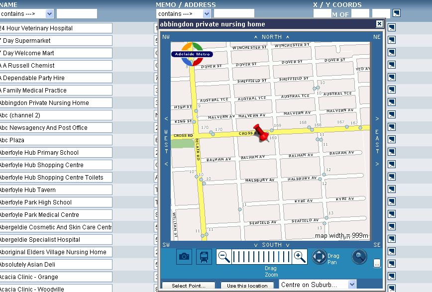
This data is editable directly in the browser:
You can show AND modify the position of any given location directly on a map:
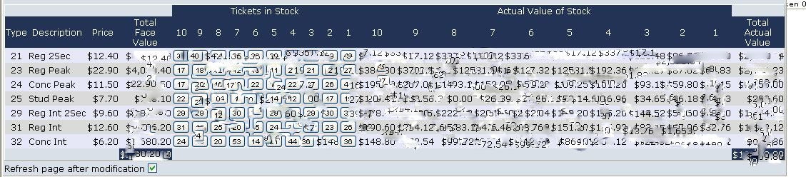
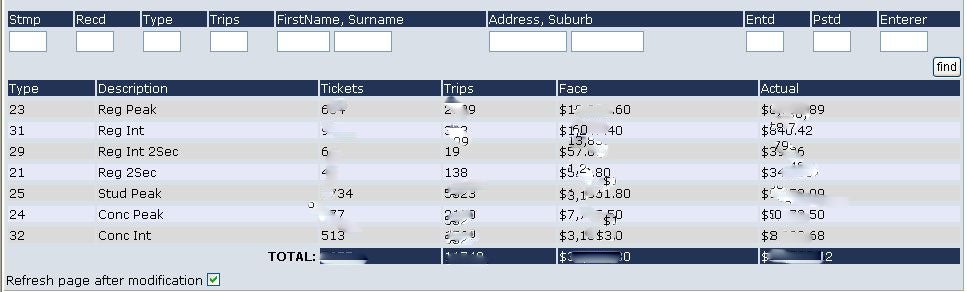
Ticketing
The system keeps track of Adelaide Metro ticket stock and replacement
transactions:
![]()
Reports with filters are available to see at a glance what’s happening at any
given time:
Keep track of inventory: